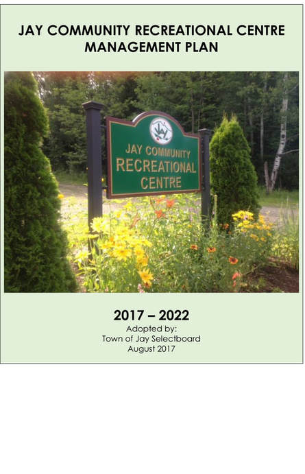
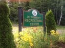
Jay Community Recreational Centre
Known prior to 1/2/2012 as Jay Community Land Trust known prior to 10/2008 as Jay Land Group Management Plan Revised August 2017 Purpose A. Goal of the JCRC Management Plan
C. Responsibilities
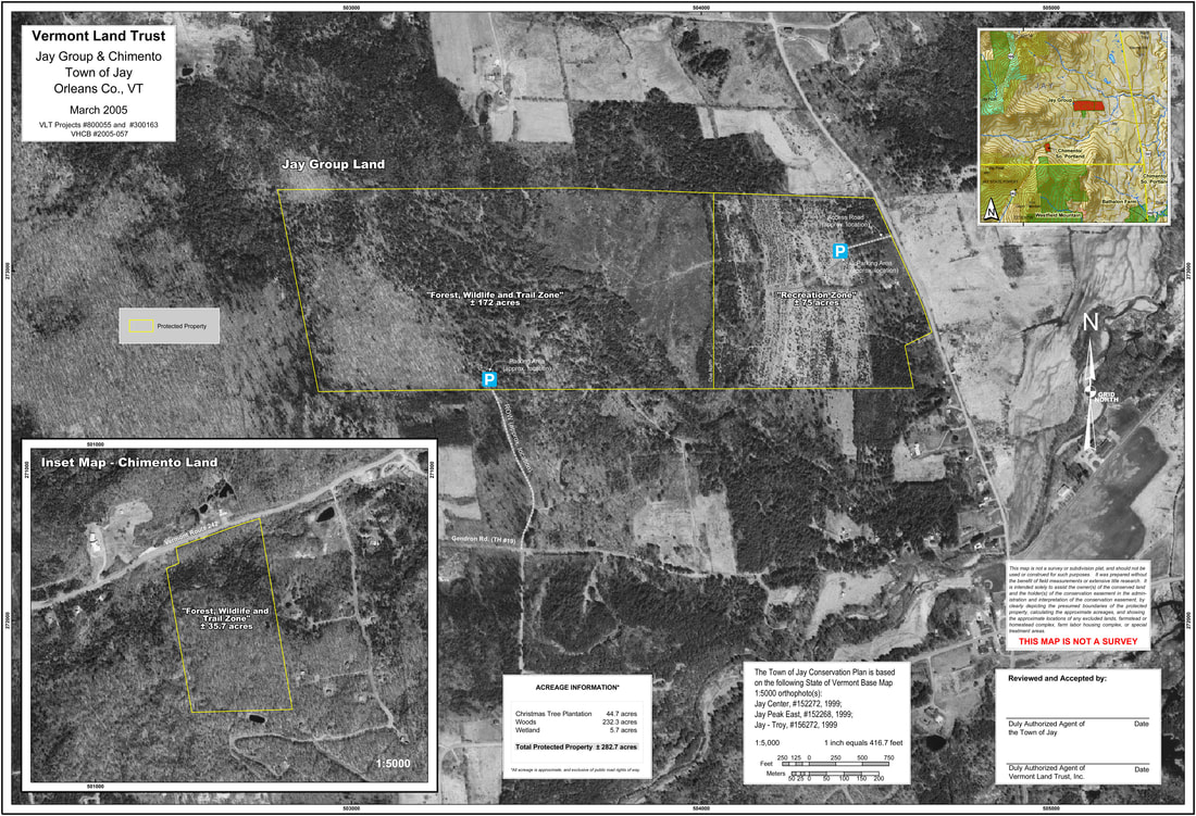
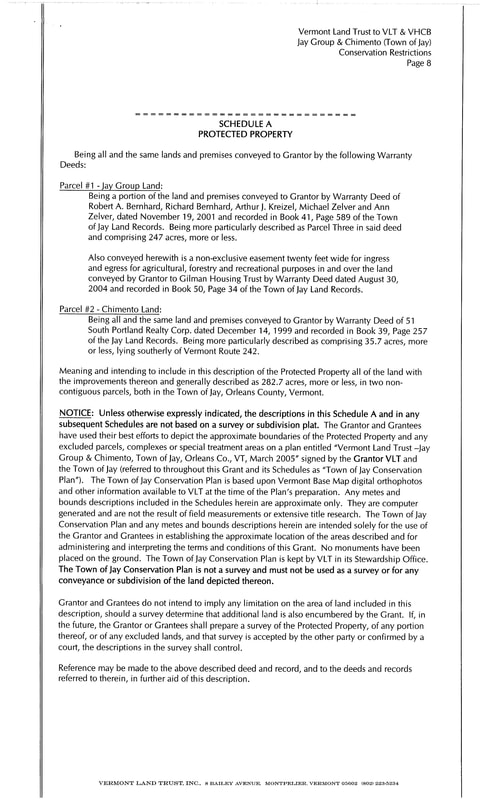
General Description of Property The Town land acquired through the Vermont Land Trust is comprised of 2 separate parcels: the Cross Road Property and the former Chimento Land. The properties include multiple resource attributes (see attached map). Approximately two-thirds of the Jay Community Recreational Centre property is mapped as deer wintering area. The Cross Road property also includes 38 acres of prime and 10 acres of statewide important agricultural soils, currently planted in Christmas trees. The former Chimento Land is located on the access road to Jay Peak, approximately one mile from the ski area. Both the Chimento and Cross Road properties are ideally located for recreational use by community members. A perpetual conservation easement will protect the two properties, securing permanent public access and ensuring town management for educational, recreational, and forestry uses. The former Jay Group land (the Cross Road property) was slated for a 58-lot subdivision in the 1970s that never came to fruition. The western two-thirds of the property is wooded and mapped as deer wintering area. This area of the property also includes several small streams and a small wetland area on the western boundary. The eastern one-third of the land is relatively flat, mapped as prime and statewide agricultural soils. This area has 1,400 feet of frontage on Cross Road and is relatively close to the village center and the Jay Westfield Elementary School. This area will be managed by the Town as forestry and wildlife habitat with recreational trails interspersed throughout. The Catamount Trail Association will hold a permanent easement across the property for a new section of the Catamount cross-country ski trail. Gates and Boundary Marking and Posting The Cross Road property has a gated entrance to the Christmas tree area - the largest and most accessible section of the land. There is a second entrance to the 247-acre property on Sargent’s Way, which is included in the deed as a ROW through the Gilman Housing development and will include parking for public access. The boundaries of the land are ot clearly delineated at this time. Neighbors will be contacted regarding the plan as well as boundaries to determine whether a survey is necessary, and if so, the timetable for completing one.
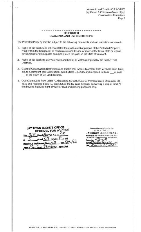
The Chimento Property currently has access only off Route 242. This access is steep and does not include any room for parking. The access issues on this parcel will be addressed through conversations with abutting landowners. The boundaries of that land are not clearly delineated either, and may require a survey. There is an open Act 250 permit on the Jay Community Recreational Centre lands. Although the acquisition of the land through the Vermont Land Trust does not allow for development of the JCRC, since some of the property was developed by Gilman Housing, we cannot ask for an abandonment of the Act 250 permit, which is transferred from landowner to landowner indefinitely-(As per consultation with Kirsten Sultan, ANR 2017). In general, any new activities and/or construction, depending upon specific project and location, may be considered a “Material Change” and may require amendments to the Act 250 permit. Consultation with ANR will be made in the event of any new activities and/or construction. Current Physical Improvements to Property At the time of acquisition, there were no physical improvements to the Jay Community Recreational Centre-Cross Road property except for existing trails that were used for the Christmas tree operation, and a small parking area on Cross Road. The Chimento property did not and currently does not have any physical improvements. Description of Proposed Physical Improvements to Property In the Conservation Easement, the properties are zoned for different types and intensity of uses: Parking Zone, Recreation Zone, and Forest and Trail Zone (see attached map).
Completed as of December 2011
Completed as of June 2017
1 - 5 year Plan
5 – 10 year Plan
Long-term Plan
Natural Features Inventory The natural features of the property may be inventoried and the information used to adjust Management Plan recommendations in the future. Management Plan Update
|
Jay Community Recreational Centre Management Plan
Jay Community Recreational Centre’s Management Plan details the strategies to achieve our goals and is supported by a five-year action plan, the implementation of which is already underway. This Plan also defines our mission, values and benchmarks that we will use to measure our success. Most importantly, this Management Plan clarifies our commitment to land conservation in the greater Jay community. To accomplish our land protection and stewardship goals, JCRC must be a strong organization with excellent leadership, skilled management, and sustainable funding. To guide our work and respond to the challenges before us, this Management Plan articulates four specific goals: 1. STEWARDSHIP: JCRC properties are sustainably managed to maintain and enhance their conservation values. JCRC properties are town owned, and we encourage their use and enjoyment by the community. Caring for conserved land is a forever job -- one which we take very seriously and enjoy. 2. FUNDRAISING: JCRC seeks sufficient funds to meet its trail and trailhead development goals, respond to community recreational needs, fulfill its perpetual stewardship obligations, and support annual operations. 3. SOLID COMMUNITY ENGAGEMENT AND COLLABORATIONS: Effective collaborative efforts with people and systems throughout the community provide direction, resources, opportunities for learning, collaboration and interaction, and follow-through to implement JCRC’s mission. 4. DEDICATION: This plan is dedicated to the greater Jay community and the generous supporters of the JCRC. Conserved lands and the activities they offer, are the snap shots community members and visitors alike choose as their “take-home message.” OUR VISION The Jay Community Recreational Centre seeks to protect and enhance outdoor recreational activities and Jay’s landscape forever, and for the benefit of all. Our vision for the future is, Jay is a beautiful and healthy place with exceptional free recreation opportunities for residents and visitors. OUR MISSION JCRC is dedicated to promoting the health and well-being of the community of Jay through the protection and conservation of forest resources, wildlife habitat, low cost recreational and educational opportunities, and other natural resources on the Protected Property for present and future generations. EXECUTIVE SUMMARY Jay’s natural beauty is a fundamental force that defines our sense of place. Undeveloped, open and forested spaces maintain Jay’s authenticity and rural New England character. It is this unique landscape that lends inspiration to our daily lives, provides a myriad of outdoor recreation opportunities, and draws visitors from far and wide. Conserved lands and the activities they offer, are the snap shots community members and visitors alike choose to remember and return. Changes to the Jay landscape over the coming decades will define our community into the future. This document is an overview of a plan designed to guide our JCRC land protection activities, so that our community can continue to thrive as a great place to live, work, recreate, and raise families. The plan defines a shared vision for land protection at JCRC, and effective, efficient systems to realize the vision. RECREATION
The JCRC property on the Cross Road is a 240+ acre parcel of former Christmas Tree Farm and forested land. It is a primary goal that the trails and activities located on the property be 4-season and multi-use. A second goal is to help protect and establish connections between existing trail networks and recreational hubs. Critical corridors include: between the Catamount Trail and the JCRC, Jay Peak and the JCRC, including the linkage to Montgomery. GOAL The essential character and function of the JCRC is to conserve and protect these properties; thereby creating a 4-season community recreational area with multi-use public access to and between other community recreation areas. RECREATION PRIORITIES Maintain existing trail networks and connections between them. Establish community features such as outhouses, under-cover area and trail features. Develop a clear plan for the future management of trails, facilities and public access. STRATEGIES Collaborate with recreation partners to participate in local trail and recreation planning initiatives. Continue to support the sound management of JCRC’s existing protected trails and recreation features. JCRC—A CALL TO ACTION Thanks to the support of many, we have successfully worked nearly 15 years to improve a free 4-season, multi-use recreational opportunities for our community. With this updated JCRC Management Plan, the JCRC continues our trail development and stewardship work. We invite you to join us today. Together, we can protect our landscape and continue to provide a variety of recreational opportunities for the benefit of all. We invite you to:
Do you have a personal story about how Jay Community Recreational Centre has made a difference in your life? Perhaps a memorable hike, meaningful time with family, a life-changing event, or a reason why you visited, moved, or stayed here. Your stories - all of them - add up to why we do this important land conservation work. So please share them with us. Whether several words, a few paragraphs, or a photo, we want to hear from you. Thanks for sharing your story! JCRC EMAIL ADDRESS: [email protected]
|
Jay Community Recreational Centre
Mailing Address: 1036 VT Route 242, Jay, Vermont 05859
Trailhead: Cross Road, Jay, Vermont 05859
www.jaycommunityrecreationalcentre.org
Email: [email protected]
GPS Coordinates: N44.95812, W072.44236
Contacts: Sally Rivard-802.318.1206 or Denise M. Rossignol-516.901.1857
©2015-Jay Community Recreational Centre
Proudly powered by Weebly